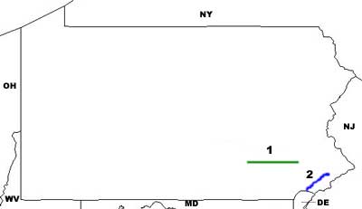
Trainwatching Sites
ALLENTOWN -- CP BETHLEHEM (December 21, 2001)
On Conrail, "CP" means controlled point, and these are what is often referred to as an electronic tower. CP Bethlehem is named for the line that led southeast from this location to the city of Bethlehem and the defunct Bethlehem Steel Plant. CP Bethlehem is located under the PA-378 bridge immediately south of the Lehigh River. Get off PA-378 at PA-412, and go north and west to the CPt. Stay off railroad property. The traffic on PA-378 is noisy, so trains can sneak up on you. Be alert, and again, stay off railroad property. The fate of Bethlehem Steel and its railroads and other assets, nationwide, is unsettled.
At the CP, 2 things happen: 1) All freights which go thru the classification yard north of the river come over the river here and join 2) All trains which do not use the main yard (these are mostly intermodal) don't go over the river, but continue due southwest towards the west end of the metro area. You will probably see more than one train per hour here.
ALLENTOWN -- CP BURN December 1992
What CP-Beth is in the eastern part of Allentown, CP-Burn is to the west of the town. The west-bound lines coming from the freight classification yard north of the Lehigh River, and that from the intermodal yard (which is largely defunct now, as the new Rutherford facility east of Harrisburg is taking care of the entire northeast intermodal classification) south of the river join at CP-Burn, and head towards Harrisburg. Burn gets its name from Auburn Street, which is adjacent to the junction. [The latter tidbit from Sean McDonnell.]
To get to this location, go west on Union Street, over the river, and then south on PA-145, which is Basin Street. Just south of the railroad underpass, CP-Burn will be on your right. It is NOT advised to railfan in the old open lot adjacent to CP-BURN. There is a lot a little further south which is supposedly off railroad property. This is a dead north-south location, so choose photo locations based on the sun. You have a good chance of seeing other railfans at this location. Be alert, and stay off all railroad property.
[Note: This material was adapted from info provided by TRAINS Magazine in December of 1992. If you don't subscribe to TRAINS, well, you should. It's an excellent publication. Get on its web site here. ]
ALTOONA -- OVERHEAD SHOT LOCATIONS (September 10, 1998)
1. For an overhead shot with straight track, two places are the 17th Street Bridge and the Riggles Gap/Township Road 4018 bridge. You might also want to know that the new Route 24 and 1/2 Street Bridge has chain link fencing, making it difficult to get satisfactory pix.
Drew McGhee supplied this info for us.
2. There is a pedestrian footbridge right next to the Amtrak station, which leads over the 5 tracks in service, and comes out between Altoona Pipe & Steel and the Railroaders Memorial Museum. There are great photo ops here, as both east- and westbounds are easily visible from both sides of the overpass. If Altoona Pipe & Steel is being switched, the action would also be visible from this location.
Sean McDonnell was kind enough to provide this information.
BADEN(October 22, 1999)
In the giant Conway yard area, there are very few places to see trains. Don't get me wrong -- they're everywhere, but PA-65 runs along the east end, and there is no room between the tracks and the road. The western side of the yard is either railroad property, or is used for rail/barge transloading. So many trains, engines, and cars, and no place to railfan. Well, there is one place, and it's excellent.
From the junction of PA-68 and PA-65 in Rochester, come south on PA-65, until you are almost past the entire yard complex. You'll see a sign for the business district of the town of Baden, and a left-turn lane. Take this left onto State Street in Baden, and park very shortly at the foot of Pinney Street. Walk across PA-65, and onto the road ramp over the yard throat. There is a sidewalk on the north side of the overpass, and all arrivals and departures can be seen and photographed here. Be smart: Stay out of the roadway, and act responsibly. This is a great railfan location, and a few idiots could spoil it for all of us.
In the early morning, hanging wires may interfere with some shots, but from mid-morning on, the lighting is good. Even though the photography is "down-on", the area is wide enough, especially in the afternoon, to give you enough lateral distance to yield pretty decent results. This is a premier train-watching location.
Joe Jack of Conrail, Sean McDonnell, and Terry Stuart of the Fallston Flagstop , all provided assistance with this location.
BUTLER -- BESSEMER AND LAKE ERIE (October 23, 1999)
From the intersection of US-422, PA-38 and PA-68, take PA-38 north to Hendricks Road (about 1/4 - 1/2 mile), and turn left. You will almost immediately cross the main and yard lead tracks. The yard itself is to the right, complete with yard tower and tiny engine facility. On the left are several long storage tracks for coal cars. There may be road engines of CSX or BLE here, but DO NOT, however, venture on any railroad property. Park just past the crossing on the left, and wait for the railroad to come to you!
Joe Jack provided some much-needed map and written assistance for this posting.
BUTLER -- BUFFALO AND PITTSBURGH (October 23, 1999)
From the corner of US-422 and PA-68, take the dirt road down to the engine facility and yard (SW corner of the intersection). Ask for photo permission in the office. Units (2-8) are very tight, but a few good photos are possible. Buffalo and Pittsburgh is very busy in this area, and you might scout out some off-property photo sites.
Joe Jack provided some much-needed map and written assistance for this posting.
CASSANDRA(June 4, 2000)
This is a town which not only understands railfans, it welcomes them! From Altoona, take US-22 west to the Portage exit. At the stop sign at the ramp, take a left, and go south on PA-53. You'll go thru Lilly, and within 3-4 miles, you'll descend the hill above Cassandra, and need to look for the "Railroad Overlook" and Cassandra directional signs. Make a very sharp (almost a U-turn) right turn, and follow the road into Cassandra. At the "T" intersection in town, turn right at the "Railroad Overlook" sign. Follow this road until it dead ends. A "Welcome Railfans" sign is located at the entrance to the overlook.
The overlook bridge spans all three tracks from east to west. You'll have good photo ops all day.
We're indebted to John Shuniak, mayor of Cassandra, who was kind enough to share this information with us.
CLAYSBURG (September 2000)
Pennsylvania is stuffed with small towns, and more than a few of them have railroad significance. Here's one for you. The Everett Railroad is a short line which operates south and west from the Holidaysburg area south of Altoona. Nothing fancy here, just a pragmatic 2-stall engine house. Come around and take your chances, and you might get lucky.
From Altoona, go south on I-99/US-220 to exit 23, and then continue south on Old Highway 220. As you get into Claysburg, take a left to go to the tracks on Cross Street. Between Cross Street and Packard Street via Railroad Street, pretty much anything the Everett has to offer should be visible.
This information thanks to T. N. Colbert, K3HX.
CONFLUENCE (July 16, 2000)
In the southwest part of the state, is a vacation paradise. There are abundant hiking, camping, float trip opportunities, and lots of things I haven't mentioned. Amazingly, except for big summer weekends, this area is not over run with tourists during weekdays. There is good railfan activity in the area, and Corey Vernier gives us this report.
From I-68 west of Cumberland, Maryland, take exit 14 north on US-40, and drive into Pennsylvania. About 1 miles west of the Pennsylvania state line, take a right, and go north on PA-281 towards Confluence. The town is 7 miles from US-40, and the drive is like all the others up there -- beautiful, but don't try to hurry. When you come into the town, you'll cross two rivers, and PA-281 will take you right to the tracks. Abandoned tracks in the area are ex-Western Maryland. Nothing is level here, but with some planning and imagination, you can get some good photos.
This is the Cumberland - Sand Patch - Connellsville - Pittsburgh main line, so you'll see some action. It can be heavy, but like most railroads, it can be sporadic.
CRESSON (September 14, 1998)
CR First, if at all possible, stay at the Station
Inn Bed & Breakfast. It's directly across the street from the Main
Line, and has a big, comfortable porch from which you can watch
Conrail's grand parade stride by. In the lower level of the Inn, there
is a pub in which light food is served, as well as most welcome adult
beverages. Note the following from the Inn's brochure, in case you are
traveling with a non-RR loving spouse:
"The Inn is unlike
most B&Bs. It is close to a busy railroad. The Inn is not air
conditioned; it has no in-room television or telephones. There are no
farm animals in the back yard. The Inn has no antiques, no Early
American furnishings, no homemade bread or jam. The Inn may not meet the
needs of typical B&B travelers."
That said, this is THE place to stay for any railfan:
The Station Inn
827 Front Street
Cresson, PA 16630
Info: (814) 886-4757
Reservations (get them early!): (800) 555-4757
CR Second, Cresson is the base for helpers to Altoona to the east, and Johnstown to the west. There is lots of good viewing on the east side of the tracks, and there is even a town-provided observation stand. However, there are also nasty, heavy wires obscuring much of the view. Choose your site well, and you'll do better than from the observation platform. On the west side of the tracks, just beyond where the Veterans' Memorial Underpass egresses, there is excellent vantage for off property shots. In the proper lighting, this is the best place I've found.
CRESSON -- ROUTE 53 OPPORTUNITIES (September 10, 1997)
PA Route 53 comes from the north, and crosses the mainline midway between Gallitzin and Cresson. On page 54 of the September 1995 TRAINS* is a photo from this location. This looks to be an excellent place to catch the action on a section of the mainline with 5 (count 'em) tracks! As you travel further south on PA 53, the map indicates that the road plays tag with the Little Conemaugh River and the mainline, at least as far as US 219, just east of South Fork. If you have time and are willing to exercise a little, you will have several photo locations along the way.
* What? You don't subscribe to TRAINS? And you call yourself a railfan? Contact TRAINS here and sign up for a darned good magazine.
DUNCANSVILLE (September 2000)
Duncansville and Holidaysburg run together, on an east - west bias, south of Altoona. From the old car shops at Holidaysburg the PRR went west to a wye, with the north leg leading up to Altoona. Today, the wye is still in place, but the car shops are either defunct or rapidly becoming so. However, just west of the wye, in the political entity known as Duncansville, the Everett Railroad is alive and well.
To get there, perhaps the simplest, albeit not the fastest) way is from the junction of US-22 and PA-36 in the center of Holidaysburg. Go west on US-22, and continue west on Old US-22, which will take you right thru Duncansville. The west leg of the wye will be just before the I-99 underpass, and you'll see a "new" depot in the area, and will often see an EV unit placidly awaiting its next assignment.
This information thanks to T. N. Colbert, K3HX.
EDDYSTONE (November 25, 1998)
This is a southern suburb of Philadelphia, just north of Chester. It is the historic site of the Baldwin Locomotive Works, and more importantly to railfans today, is the site of a small SEPTA suburban commuter station. The nice thing about Eddystone is that there are few people around to get between your lens and the trains, and the area is quite safe. There are grassy areas on both east and west sides of the tracks, and there is a nice, long curve coming from the north. There are good photo ops here. Amtrak trains hustle right along, but they seem to go slower than the 100+ MPH found on more southerly portions of the NEC.
Eddystone is off I-95, but I don't know the exact exit name or number. However, it's pretty probable that the best exit is #8, and from Industrial Highway, go south to Saville Avenue in Eddystone. As always, a good map is indispensable. Eddystone is in the extreme SE corner of Delaware County.
FAIRHOPE (October 16, 1999)
This tiny spot on the map between Hyndman and Sand Patch is worth a visit. From downtown Cumberland, Maryland, go west on US-40Alternate, and then north on MD-36. After a short while, go north on MD-35, and begin your long association with Wills Creek. Remain on MD-35 as it changes to PA-96 north of the Pennsylvania border. At Hyndman (and here you have to pay close attention) there is one traffic light. After going thru the light, you want to turn left onto PA-3004. This is very easy to miss, as the road is not auspiciously posted; however, if you come to a grade crossing in Hyndman before turning left, you know you've come too far. Do a U-turn, and take your 5th right onto PA-3004.
After all this, meander thru the country on PA-3004, keeping company with Wills Creek and the CSX mainline, until you reach Fairhope, maybe 4-5 miles. This is a tiny "don't blink" place, and you want to go straight here and over Wills Creek to the at-grade crossing. There is ample space from off-property to enable you to choose for good photo angles.
With thanks to Markolf Gudjons of Aachen, Germany, for this information.
FALLSTON -- FALLSTON FLAGSTOP (October 21, 1999)
Terry Stuart has established "THE FALLSTON FLAGSTOP" as a railroad-oriented B&B in Fallston, which is a Pittsburgh area 'burb, in the Beaver River Valley just north of Conrail's giant Conway Yard. The house itself is physically next to the CSX mainline, and just across the Beaver River from Norfolk Southern's parade of Alliance and Youngstown-bound trains. These are clearly visible, and with a good, mid-range telephoto lens, good photos can be had. Five trains per hour(!) rumble thru here, and the evening sees floodlighted goodies going by from the comfort of the establishment's porch. A pretty nice way to railfan, if you ask your friendly webauthor. Rates are pretty reasonable, and Terry offers personal area tours, which would be quite a boon for the serious visiting railfan, because the Pittsburgh area is rather difficult to navigate.
Terry really knows the rail scene in the entire area, and it's a pleasure to sit in a comfortable chair for an extended period of time, just talking about the rail scene with such a fellow.
For reservations and directions to TFF, contact Terry at the following:
Tel: (724) 843-7023
E-mail: tstuart@forcomm.net
Snail mail:
The Fallston Flagstop
62 Beaver Street
Fallston, PA 15066
FALLSTON -- FOUNDRY AREA (October 22, 1999)
From the corner of PA-51 and Beaver Road in the village of Fallston, go north on Beaver Road. Turn right, almost immediately, onto the first dirt road you'll see, and head towards the old foundry. You want to bear right, shortly, and head up towards the CSX (ex-PL&E) tracks. Park off railroad property, and you'll have good photo access in both directions. There are signals to the south which are plainly visible. Traffic on NS (ex-CR) across the Beaver River are visible, but photography won't work, as there are small trees interfering with your line of sight.
GALLITZIN -- ALLEGANY PORTAGE MUSEUM (September 10, 1997)
From the "new" US 22, take the exit for the Allegheny Portage National Historic Site. Follow the excellent signs. The Site is a "must see" for any railfan--casual or nutso. This was a railroad like nothing we would imagine today. When completed, it reduced the time between Pittsburgh and Philadelphia from a backbreaking three weeks to several days. As usual, the National Part Service has done an excellent job with displays, and there is even a full-scale replica of a c.1834 steam engine which is most definitely not your basic 4-4-0. There is also a reconstructed engine/pulley house, which is worth the visit by itself. Take the time to walk down the incline from the engine house, and then walk up, and you'll quickly understand what an engineering marvel this railroad was.
GALLITZIN -- THE TUNNELS (September 10, 1997)
CR Tunnel Park. From the Allegheny Portage National Historic Site, go north to the town of Gallitzin, and follow the signs to the park. The small (but with two big Catholic churches!) town of Gallitzin has put together a pretty little park at the mouth of the tunnel bores. Good photos from above can be had from the park, as well as from the street bridge (Jackson Street) over the tracks. There are pedestrian walkways on both sides of the street bridge. Down below, to the west of the street bridge, excellent off-RR property photos are possible. This is a superior site, with lots of trains (and they move right along!).
GALLITZIN -- TRACK 3 (September 10-14, 1998)
From the twin tunnel park downtown, go west on Jackson Street (that's the overpass street at the tunnels) about 5-6 blocks. Because of one-way streets, you'll need to go north one block before you can go west to the 3rd track. You can't miss it, really. The third track was part of the New Portage Railroad, and its tunnel is called the New Portage Tunnel. Mainly eastbound traffic uses this track, as it has at least a 2% downgrade (going east).
Once here, the road goes over the third track. If you look railroad-east, the track seems to drop off the side of the mountain. If you look railroad-west, there is a fairly long (for this part of the world!) straight track with a tower [AR] off to the right in the distance, and lots of trees and a cut to make the scene complete.
There are lots of folks to thank for this info, but I'd especially like to thank Carl Haslett, Jeremy Helms and J. Alex Lang. Their input, plus that of a few others, make this site a success.
HARTSTOWN (March 30, 2000)
From Greenville, travel north on PA-18 to its intersection with US-322. This is Hartstown. At the intersection, go right on US-322. Then, go one block over the overpass to Cemetery Street, and make a hard right onto a dirt road, which will end at the Bessemer and Lake Erie tracks. This is the CN (ex-BLE mainline), and it sees perhaps 10 trains a day. There is no grade crossing here. This is also the south end of a siding, so you might find some good pickings here. This is a place to relax and let the trains come to you, so for Heaven's sake, have a cooler of tea or coffee to keep you company.
Note that US-322 does not cross the tracks at grade; it uses an overpass to get across the tracks. Carl Timko points out that if you're going north on US-322 (actually eastbound, officially), there is a small dirt drive which will take you down to the tracks. MoW crews and local fishermen use this road. There is reportedly a defect detector at or near this location. For life support, if you're hungry, go back to the intersection of US-322 and PA-18, where there is a restaurant.
Southbounds are well lighted for photos in the mornings, but not northbounds.
Joe Jack, a railroad insider in this area, has provided detailed map and text to your webauthor. If something is wrong in this description, call your webmaster, not Joe!
Andy Koenigsberg and Carl Timko have provided some clarification of the original data your webmaster posted. Thanks, guys.
HOLLIDAYSBURG (970909)
CR Site of a large PRR car shop, and still a very active CR facility. Parallel to US 22 in the south part of town. There is at least one SW1500 stationed here, and there is also a job that runs from Altoona to Hollidaysburg and return. This is apparently on an every weekday (?) schedule, and the power is generally an SD40-2. The job brings cars for repair to both the CR shop and the Berwin Shop. Berwin is a contract maintenance facility, and is quite active. I did not see any motive power in Berwin's complex, which is directly across US 22 from the CR yard area, at the east end of town.
Dining The US Hotel is excellent, and in a most historic building. The food is gourmet and pretty expensive, but oh, my, is it ever good!
Lodging The Hoenstein Bed & Breakfast. This is in an historically significant home in the downtown area, and is quite nice. At rates of $40-$70, you will spend no more than in area motels, and will be most happy with the accommodations--this is no motel. Walk to the CR shops, dining, churches, etc. Very enjoyable place to stay. Altoona is about 6-8 miles away.
Hoenstein's B&B
418 Montgomery Street
Hollidaysburg, PA 16648
(814) 695-0632
HOMEWOOD
From the westernmost exit on the Pennsylvania Turnpike, take PA-60 (an expressway) south. MAKE SURE YOU HAVE 50 CENTS IN EXACT CHANGE. Leave PA-60 at the first exit, PA-551, and take it east. Just before going through a concrete arch labeled "Pennsylvania", turn left onto Norwood Avenue. Take this road north for 2-3 miles. It will become 11th Avenue. As you enter the village of Homewood, the road will curve right and go over railroad tracks. This area of trackage constitutes Homewood Junction.
The Standard Railroad of the World comes up from Pittsburgh and swings west here to go to Alliance, Ohio, and then on to Cleveland and Chicago, and St. Louis. The actual junction is with a Pennsy line that followed the west bank of the Beaver River and on towards Youngstown. That trackage is now terminated north of New Castle. The main draw, of course, is today's Norfolk Southern Alliance - Pittsburgh traffic, which is booming.
The interlocking you can see from the bridge is CP-Wood. Rob Richardson, who was kind enough to provide this information for this railfan site, says: "The bridge gives an excellent view of CP Wood and its unbelievably large old Pennsy signals. Each track has a two-head mast, and each head must be five feet in diameter!"
HUNTINGDON (January 2, 1999)
In Huntingdon, a burg of less than 7,000 folks, the NS (ex-CR, exx-PC, exxx-PRR) mainline whizzes along between Harrisburg and Altoona. There is a tower, Hunt Tower, in town, and this is a good place to see the action. Stay off railroad property. Also, traveling on US-22 between Huntingdon and Mount Union yields several photo locations.
Thanks to Jeffrey Damerst for this info.
JIM THORPE -- GLEN ONOKO (June 2008)
Glen Onoko was the site of an hotel and amusement park operated by the Lehigh Valley Railroad. The resort was destroyed in a fire in 1929. It was also the site of a coal marshalling and forwarding yard. Today, it's the site of a parking lot yielding access to the Lehigh Gorge State Park. The Central of New Jersey and Lehigh Valley railroads went thru, side-by-side, on the east (north) bank of the Lehigh River here back in the day. The CNJ was torn up long ago, and its roadbed is now a rail trail extending from White Haven in the north to Glen Onoko. It's a terrific trail, offering gorgeous scenery, a roaring river, and, a few times a day, trains of the Reading and Blue Mountain, Canadian Pacific, and Norfolk Southern railroads, all of which use the ex-Lehigh Valley tracks.
From downtown Jim Thorpe at the intersection of US-209 and PA-903, go northwest across the river via PA-903. This will become Front Street, and after 3 blocks it will make a 90º turn to the right -- do not make the turn, but continue straight ahead. Be careful, as the traffic coming down PA-903 towards you has the right of way. The street is now named Coalport Road, and there will shortly be a turn to the left, which will take you to the parking area. You'll see a railroad and hiker's bridge come in on the left. The track is used by the Lehigh Gorge Scenic Railway's passenger trains. Lehigh Gorge Scenic is an RBMN subsidiary. You can get the schedule by Googling the excursion line.
North of the parking lot is the trail going 25 miles up to White Haven, with the first 8 miles or so next to the active rail line up to M&H Junction.
The November 2007 Railpace Magazine had a very nice feature article about this area, and it was a great help to your Webmaster when he visited in June, 2008. Much more info about Glen Okono, including maps, are in the article.
JIM THORPE -- STATION AREA (June 2008)
Jim Thorpe is a tourist tour, and rightly so. Its setting within the Lehigh River valley is gorgeous, and you can ski in winter, kayak in summer, ride a bike or take some hikes. US-209 runs thru the downtown area, and the ex-Central Railroad of New Jersey station is the iconic focal point of the town. You can also take a train ride from the station, and you'll find the Reading and Northern's passenger train engines and cars just north of the station.
Do not cross the tracks, as you may be ticketed for doing so, as this is still a "live" track, even though the bulk of the traffic thru this part of the valley is on the east bank. The best way to see the cars is to walk across the railroad into the paid parking lot that is between the river and the tracks -- opposite from the station. Walk to the northern extent of the lot and take your pix. There are 2 CNJ-painted F3's often in attendence, but the train is usually powered by an R&N geep on each end. Google Lehigh Gorge Scenic Railway for details concerning schedules, tickets, etc. When the train is boarding or letting off passengers, you can get the engine on the south end in good light just to the south of the station in the afternoon.
The November 2007 Railpace Magazine had a very nice feature article about this area, and it was a great help to your Webmaster when he visited in June, 2008.
LANESBORO -- STARRUCCA VIADUCT (August, 2001)
There are bridges, and there are bridges. Sometimes the statistics don't do an adequate job of describing a bridge. Starrucca is one such place -- you truly must see it to believe it. Beginning in the town of Susquehanna, at the junction of PA-92 and PA-171, go east on PA-92 about 4 miles to the small crossroads of Lanesboro. Starrucca is beautiful, but you can appreciate how terrifically expensive it must have been to construct back in 1848. Here are the numbers: 1040' long, 100' high, and 25' wide at the top. There are 14 soaring arches that were built over 150 years ago to carry the New York and Erie across the Starrucca Creek Valley. It is the oldest stone railway bridge still in use in the United States. Yes, today, the twin tracks of the New York, Susquehanna and Western still carry freight over the valley as they have for over 150 years.
Can you imagine the tonnage of the average train in 1848 as opposed to those of the early 2000's? There are trails up to the top of the bridge starting at Luciana Park under the bridge. The Delaware & Hudson's abandoned railroad bed (now a rails-to-trails hiking trail) travels under the viaduct, and goes up the Starrucca Creek valley.
We owe Bob Trueman a "thanks and a tip of the hat" for this interesting railfan location. Thanks, Bob.
LEETSDALE (October 22, 1999)
From the junction of PA-68 and PA-65 in Rochester, take PA-65 south past the Conway Yard complex to the village of Leetsdale, maybe 7 miles south of Conway. In the morning, turn left from PA-65 at Ferry Street and park in the village. Walk back across PA-65, and set your folding chair and cooler on the grassy area between PA-65 and the tracks. In the afternoon, turn right from south-bound PA-65, cross the tracks and then immediately turn right. Go along this road until it 90°'s into a residential area. At this turn, there is a small parking area for a neighborhood park. Park here and walk back to the tracks. There appears to be plenty of room between the road and the tracks to allow for excellent photo ops. Further south, there is also lots of grass between the industrial lead road and the tracks, but parking is a major problem (so scout around, already).
This is a superior railfan location.
LEHIGHTON -- KOVACH OVERLOOK (June 2008)
The Kovach name is everywhere in the Lehighton/Lehigh Valley area. One of the Kovach properties is their used car lot on the east side of US-209 in Lehighton, just north of the split into one-way traffic. The dealer has recently extended the lot to the east by using a bulldozer to spread fill. At the extreme rear of the lot, there is a very nice overhead view of the tracks far below in the valley. Get permission first, but this is a pretty cool site. The street, railroad and river are pretty much north-south here.
LEWISTOWN (September 9, 1998)
A small town off US 322, which offers photo ops on the NSC, ex-CR, exx-PC, exxx-PRR mainline thru the Altoona-Harrisburg corridor: Lewistown has an Amtrak station, and a highway (route 103 (?) ) bridge over a curve allowing you to view down a straight section of track. The station itself is the oldest station still in existence on the old PRR, and there are often railfans in the area. There is a crossover right in front of the station.
This info thanks to Dan Rapak, who is an active member of the Conrail-Talk info group, and from Jeffrey Damerst, who knows the territory.
LILLY(September 10, 1997)
CR. This small town is between Cresson and Portage, on PA 53. Good, open, off-RR property vantage points exist in this small town, but the trains are rockin' and rollin' right along.
MEXICO(February 22, 2002)
A nice article in the Railfan Info section of trains.com, the website for Trains Magazine, turned me on to this location. Besides considerable descriptive and historical text, there were some photos which showed what an excellent photo location this place can be. The article was written by John P. Locke, III, and it describes a point on the very busy Harrisburg -- Pittsburgh main line.
Some Yahoo map work will locate the location of Mexico, on the north bank of the Juniata River, a few miles east of the Mifflin area. The railroad location referred to as Mexico is, however, on the south side of the river, and you cannot get directly there from the north bank's Mexico. So, from Port Royal, go east (compass south) on Local Roads 333 and 75 until they split about a quarter mile south of town. Continue east on LR-333, which wanders around a bit for about a little more than 3 miles, and then takes a fairly hard 90° NE-SE curve. There will be a dirt road to your left (north) heading towards the tracks, which are between LR-333 and the river.
John's photos make it clear that good railroad viewing and photography is possible here, as you're fairly well back from the tracks, but remember that Tuscarora Mountain (a very long SW-NE ridge) is at your back, making early AM photos difficult at best.
MIFFLINTOWN (September 9, 1998)
A small town off US 322, which offers photo ops on the NSC, ex-CR, exx-PC, exxx-PRR mainline thru the Altoona-Harrisburg corridor: Mifflintown has the distinction of possessing a highway overpass (PA 35), which gives a good overhead shot to the several-tracked mainline. There is also a PRR station still standing.
This info thanks to Dan Rapak, who is an active member of the Conrail-Talk info group, which can be accessed here.
NEW BRIGHTON -- BIG ROCK PARK (October 22, 1999)
This is another place to combine family fun and railfanning, although the latter isn't much to write home about. From the junction of PA-68 and PA-65, head north on PA-65. In New Brighton, turn left (west) on 8th Street, and head toward the tracks and the river. You will go under the tracks via an underpass from hell, and then turn right into the park. Go thru the entrance to the park, and drive all the way to the end of the road. You'll go under the impressive NS (ex-CR) Fort Wayne line over the Beaver River. There are picnic tables and lots of grassy areas here on the bank of the Beaver River, and the kids will probably enjoy running around and letting off steam.
Continue back to the entrance to the park. On your left, right at the entrance, you'll see a road/track up to the track level. Park and walk up to the tracks; now, here you'll be trespassing, and I do not advise it generally. However, the engineering feat the Pennsylvania Railroad engineers pulled off here is really something. Here, the two outer tracks, which are the Fort Wayne Line, loop around and over the Youngstown Line's two inner tracks, which dive underneath and run up towards Ashtabula, while the Fort Wayne Line's tracks run over the Beaver River on it's way to Alliance and Indianapolis and Cleveland. This is a real engineering tour de force: take a picture or two, but then get off railroad property and back down to your car.
Joe Jack of Conrail, Sean McDonnell, and Terry Stuart of the Fallston Flagstop, all provided assistance with this location.
NEW CASTLE -- CARBON (November 18, 2000)
From the big yard in New Castle to Willard, Ohio, the CSX is a double tracked, busy -- very busy -- railroad. Good places to railfan are not particularly plentiful, as, over the years, increases in train speed and frequency have eliminated public access to much of the line. Here is a pleasant exception. This area west of New Castle is shown as "North Edinburg" by MapQuest, but Carl says the locals know it as "Carbon". Here's how to get there:
From the intersection of US-224/PA-60, go west on US-224 (watch your numbers here, as US-422 is just north of this intersection), pass the regional airport, and the road will swing to the south. Just before crossing over the tracks, turn right at the PA-551 intersection. However, do not take the very sharp turn north onto PA-551; go across PA-551 and enter East River Road. Watch for traffic, as this is a busy area.
After a mile or so, Jacobsen Road will come in from the north, and River Road will swing 90° south to a crossing. Be careful, because just before the B&O is a rail trail which is built on an old trolley line. On the south side of the tracks used to be a PL&E line, which is long gone, and the area provides lots of room for excellent viewing from the south side of the CSX tracks, and is well back from them. Don't be surprised to see trucks and 4-wheelers using the old right-of-way, however. If you continue down River Road, you'll cross the Mahoning River and come to the NS Youngstown - Pittsburgh line.
The rail trail mentioned above is worth more than a mention. This is the Stavich Bike Trail, and runs between New Castle and Struthers, Ohio, a distance of about 12 miles. The neat thing about the trail is that you are seldom in a place where you can't see the railroad action, even if you are on the north side of the tracks. This is a great family place, as the roadbed is paved, and bikes, wheelchairs and in-line skaters can all use the trail. Highly recommended.
We'd like to thank Carl Timko for this information. This is a nice family railfan destination.
NICHOLSON -- TUNKHANNOCK VIADUCT (January 1, 2001)
The Tunkhannock Viaduct is the largest reinforced-concrete structure of its kind in the world, at 2,375 feet long, and 245 feet high. Originally built in 1915 for the Erie-Lackawanna Railroad, it became a major part of the Hallstead Cutoff between Clark's Hill near Scranton, and Hallstead. The bridge stands today over the town of Nicholson, still crossed by freight trains, plus some Steamtown excursions from Scranton. The foundation of the train station for Nicholson is located at the northern end of the bridge. The original line's Nicholson freight house is now an appliance storeroom on US-11.
A favorite driving route is to get off at the first exit of I-81 in Pennsylvania, Great Bend, and follow US-11 all the way to Nicholson. US-11 follows the route of the Delaware-Lackawana (now Canadian Pacific) right into Scranton. If you're in a hurry, you can take I-81 to exit 64, and follow NY-92 into Nicholson. Incidentally, a few miles north of Nicholson, also on US-11 near Kingsley, is another bridge, the Marten's Creek viaduct, which is shorter than Tunkhannock, but of the same design.
We owe Bob Trueman a "thanks and a tip of the hat" for this interesting railfan location. Thanks, Bob.
NORRISTOWN -- ABRAMS YARD (December 21, 2001)
Abrams is a small yard along the NS (ex-RDG) Harrisburg line just east of Valley Forge National Park. The yard plays host to several locals, and is a popular train-watching spot. Traffic originating in Philadelphia, South Jersey, Northern Delaware, and off the Chester Secondary (ex-CR south of Philadelphia) can be seen through here, at perhaps 10-12 trains per day. There is some traffic (6-8 per day) from the Morrisville line, which joins the Harrisburg line just east of Abrams Yard. This junction is CP-NORRIS (but at least one publication has it as Norristown Junction. Irrespective of what you call it, there is no public access to the site. Traffic off the Morrisville Line includes several mail and mixed trains.
Being close to the large and popular King of Prussia Mall complex, there is relief available to the non-train-freak members of your party.
To get to Abrams Yard from PA-23 (which runs between Conshohocken and Phoenixville), turn north on Henderson Road (traffic light intersection), and travel on Henderson through the next light. As the road curves, you will run right up along the yard. You can park off Henderson Yard, near the yard office, but be very, very sure you are not on railroad property.
Ben Russell, erudite observer of things railroady in southeastern Pennsylvania, has contributed this site for your use and enjoyment.
NORTH EAST (December, 1998)
North East is a small town of just under 5,000 souls up in the extreme northwestern part of the state. It's between Buffalo and Cleveland on the I-90 corridor (take exit 11, and go north on PA-89). In the town is the ex-NYC railroad station which today houses the Lake Shore Railway Historical Society Museum. The NS (ex-NW, exx-NKP) and CSX (ex-CR) tracks are side-by-side in front of the station, and this is the place to see trains in the area. Be prepared: The trains are often very fast, and there are lots of them, averaging between 2-4 per hour.
When you want to get away from trains and see some scenery, PA-5 skirts the Lake Erie shore area, and has lots of attractions--wineries, restaurants, scenery, etc.
This info from a trip in 1994, plus a very nice "Hot Spot" write-up in the December 1998 issue of TRAINS Magazine. If you don't subscribe to TRAINS, you should, as it's an excellent publication. Access the folks at TRAINS here.
NORTH EAST -- BORT ROAD (December 10, 1998)
Ken Stroebel has contributed this addendum to the North East area:
An excellent location to view both Conrail and Norfolk Southern (soon to become CSX and NS, respectively) is found just east of the town of North East. A small wooden bridge on Bort Road, just off US-20, provides a quiet location to view the soon-to-be-ex-Conrail, exx-NYC mainline from Buffalo to Cleveland. The double track offers a good opportunity to catch westbounds in the afternoon, coming around a slight curve prior to passing under the bridge, as traffic seems to be heaviest in the early morning and late afternoon.
Norfolk Southern's route is "a stone's throw" south of the bridge and also allows some good viewing of the less busy mainline.
Access to Bort Road is from US-20, just west of the exit from I-90. Several truck stops and a McDonalds will keep the railfan from going hungry!
OHIOPYLE (July 16, 2000)
In the southwest part of the state is a vacation paradise. There are abundant hiking, camping, float trip opportunities, and lots of things I haven't mentioned. Amazingly, except for big summer weekends, this area is not over run with tourists during weekdays. There is good railfan activity in the area, and Corey Vernier gives us this report.
From I-68 west of Cumberland, Maryland, take exit 14 north on US-40, and drive into Pennsylvania. About 16 miles west of the Pennsylvania state line, take a right, and go north on PA-381 towards Ohiopyle. The town is 6 miles from US-40, and the drive is like all the others up there -- beautiful, but don't try to hurry. Ohiopyle is perched on both banks of the Youghigheny [Webmaster's note: That's the last time I'm going to type that name -- it will be Yock from here on!] River. The river makes a big horseshoe curve here, the CSX (ex-B&O) hugs the inside of the curve, and the Western Maryland hugged the outside of the curve and crossed the river twice in days gone by.
As you drive north thru town on PA-381 you will go underneath a pedestrian bridge which was built onto the piers of the original WM bridge. You'll cross the Yock and will see the tracks of today's CSX. Before you get to the tracks, take a left into a gravel parking lot. Follow the chain link fence that is on your right and park in the corner of the lot. This is a public lot, and you can park anywhere, but this corner is the most convenient place. You can watch trains from here, as this is a great location only 20 feet or so from the tracks. However, for good photos, there's a better place.
Follow the tracks west (being careful not to walk on railroad property), around the big curve, until you get to a north-facing signal. There is a big open space here with plenty of off-railroad property for photos. The signal will give you about 5 minutes warning of an approaching train. This is the Cumberland - Sand Patch - Connellsville - Pittsburgh main line, so you'll see some action. It can be heavy, but like most railroads, it can be sporadic. Sit back and relax, and listen to the birds and the screaming people rafting on the river below you.
OSGOOD (November 18, 2000)
This is a "town" out in the middle of nowhere which no one has ever heard of -- except, perhaps for some old timey railfans. For here, next to PA-18, the Erie, NYC and BLE all crossed. Lots of Eastman Kodak product was expended here in years gone by. So why, you ask, is this non-place included in a modern day railfan guide. Because, Virginia, whoever told you that this place was just a piece of dead history has got to be slapped alongsideadahead and reminded that this is still a most interesting place to see trains. Not a lot of them, perhaps 1 every 2 hours, but a nice place all the same.
The ex-CR line only sees 2-3 trains a day, and CN (ex-BLE) pushes perhaps 10 or so each 24 hours, and alas, the old NYC-line (Cleveland area to Clarion, PA) was ripped up some 10 years ago, but there are tracks all over the place, and if you will stop and get out and talk to people, you will get an opportunity to feel what it was like not so many years ago. The uppermost level is that of the BLE Highline, and the lowest is the Lowline. The NYC was in the middle. On the south bank of the Little Shenango River, the Highline goes over the NS (ex-CR, exx-PC, exxx-Erie or something like that, anyway) in a place known as Amasa. [Webmaster's Note: In the Steam Powered Video's Comprehensive Railroad Atlas of North America, North East edition from 1993, the NYC line shows as going all the way north of Meadville and up to the Southern Tier in New York. As of May 2005, NS is running 4 coal trains per 24 hours over these tracks, which are now Western NY & PA. The line runs between Meadville to Hornell, as is being up graded to 40mph. One wonders if 4 coal trains a day warrant that type of investment, but NS does NOT foolishly throw money away. Don't be surprised to see some significant growth on this line from Canada, perhaps, in years to come.]
To get to Osgood, take PA-18 out of Greenville north to Amasa Road on your RIGHT, not your left, and drive over to the tracks. Do some exploring, and ask locals for info.
Joe Jack, a railroad insider in this area, has provided detailed map and text to your webauthor. Further, Carl Timko has given us some additional information and clarifications. If something is wrong in this description, call your webmaster, not them!
OSGOOD -- KO JUNCTION (November 18, 2000)
North of the important yard in Greenville, the small crossroads of Osgood helped with the flow of traffic in and out of the yard. At KO Junction, the southbound CN ex-BLE mainline split to form the "Highline" and the "Lowline." These weren't just nicknames, as the two lines crossed each other in Osgood a few miles south. Going north out of Osgood on PA-18, the railroad will be hard on your right (east). After two miles or so, the junction will appear, just before you get to Hogan Hill Road/KO Road. Interestingly, there is an arrow straight creek, maybe 3/4 mile long going north-northwest from the crossing of KO Road and the BLE tracks. This creek is labeled "Erie Canal" by MapQuest, and should be worth some exploration!
Webmaster's Note: In Steam Powered Video's Comprehensive Railroad Atlas of North America, North East edition from 1993, the town north of KO Junction is shown as Adamstown. This is incorrect -- it is Adamsville. Adamstown is in southeast Pennsylvania.]
We'd like to thank Carl Timko for this information.
PACKERTON -- YARD AREA (June 2008)
Going south out of Jim Thorpe via US-209, you'll go up a sizeable hill, and then back down it. You are actually tracing an oxbow in the Lehigh River which is mostly out of sight to the east. As you come down the hill you have an excellent view of a relatively flat area; this used to be the site of a good-sized Lehigh Valley Railroad yard, and the Central Railroad of New Jersey also ran thru this area, so a good deal of interchange must have taken place. Today, there are a few tracks, and still some interchange taking place. There aren't a lot of trains, but there is excellent variety, as Canadian Pacific, Norfolk Southern, and Reading & Blue Mountain all send trains thru the valley.
There is a road leading to the tracks, and at the first set of tracks is a No Trespassing sign. If you stay in back of it, you're OK. Frequently, northbound CP intermodal trains will tie up here and wait for a re-crew. This seems to happen in the afternoon, and since you're west of the tracks, you'll have good light. If you're going to spend a good bit of trackside time while you're in the area, this spot and Glen Onoko are probably the best two locations.
If you can find a legal way to get trackside, just to the north and out of sight, the railroad goes to the east/north bank of the river. This is Packerton Junction. At the junction, Lehigh Valley trains went over the river, and the CNJ trains stayed on the west bank into Jim Thorpe..
PENN HAVEN JUNCTION (June 2008)
In the winter, you can get to this spot by snowmobile, cross country skiing, or on foot if there isn't much snow. In warm weather, you can kayak, bicycle, or hike. However, unless you're driving a railroad company vehicle, you can't drive there. This remote location in the heart of the Lehigh Gorge is about 8 miles north of Jim Thorpe, and maybe 7 south of Rockport. There are two tracks: East is the Reading & Blue Mountain; west is the NS/CP. At Penn Haven Junction (PHJ), the latter takes a left, to run over to Hazelton, and the former takes a right to go over the river, and head Scranton and Binghamton. RBMN calls the location "CP Independence", and CP/NS call it M&H Junction.Because of the remoteness of the area, a fairly large solar cell array powers the switches and microwave antennas.
Between Penn Haven Junction and Glen Onoko, the Lehigh Gorge State Park trail is side-by-side with the railroads, but north of PHJ, the trail and railroad are on opposite sides of the river, and the railroad is virtually invisible.
The November 2007 Railpace Magazine had a very nice feature article about this area, and it was a great help to your Webmaster when he visited -- on a bicycle -- in June, 2008.
PHILADELPHIA -- 30TH STREET STATION (November 25, 1998)
This is a fun place to visit, explore, and enjoy train-watching. Don't be real uptight here -- just have fun. On the west side of the Schuylkill River, at the approximate intersection of 30th Street and Market, this massive facility combines SEPTA's kazillion daily movements, Amtrak's NEC and Philadelphia/Harrisburg movements, plus an occasional freight on the Conrail "High Line". If you'll take some time, explore, bring your camera, and use a little ingenuity, you'll have fun. Plus, if the weather gets really yucky, you can get decent food and drink here -- a definite plus over most railfanning locations!
A good place to start is in the Amtrak parking lot directly north of the station. In the northwest corner are great views of the engine facility. From the northeast corner are unique views of all thru Amtrak action. I'd suggest bringing a short, 1-2 step stepladder to stand on. I'm short, and need a boost to get decent pix here, and suspect that even tall folks would get tired of stretching over the walls here. If Amtrak has it, you'll probably see it here.
For general information on railfanning in Philadelphia, click here.
PHILADELPHIA -- ART MUSEUM TUNNEL (December 19, 1999)
There is a small parking area almost directly under I-676 on the east bank of the Schuylkill River. Park here and walk along the "public" trails north to the museum area. You can actually walk on the bridge/embankment over the mouth of the tunnel. In the late fall, winter, and early spring, pretty good shots can be had here, at the south (east) end of the tunnel. Scout it out ahead of time. Traffic is now mostly all CSX.
As an update, Rich Jahn advises against using this place as a railfan site. He says of the site: "It is tight and overgrown and full of shadows 90% of the (time)". Try instead the Vine Street Interlocking. Your webmaster concurs, but it is an interesting place to visit once.
For general information on railfanning in Philadelphia, click here.
PHILADELPHIA -- CP BELMONT (November 25, 1998)
North of Zoo Tower, in Fairmount Park, is CP (Controlled Point, i.e., an electronic tower) Belmont, one of the best places to see freight action in the Philadelphia area. Here, freight activity from Greenwich Yard comes west across the Schuylkill River and joins the Conrail line coming up from the end of the High Line at Zoo Tower.
In the morning and early afternoon, access is via West River Drive [NOTE: WRD is closed to vehicular traffic, April-October, Saturday and Sunday mornings, so pedestrians, bikers, roller bladers, etc., can enjoy the park. Check the closing times with the Philadelphia Police if this is important to you.] Take exit 35 from the Schuylkill Expressway, and drive east on Montgomery Drive. Drive or walk (if it's closed to vehicles) north on WRD until you come to a large gray stone building on your left. These are the "stables." Immediately past the stables, take your first left, and park in the lot/area behind the "cottage". Walk up the dirt road west of the cottage/stables to the "Victory Gardens" area. CP Belmont is immediately in front of you. This is primarily a morning and early afternoon location.
Another interesting vantage point at CP Belmont is attained by turning from WRD (BEFORE you get to the stables) at the maintenance building. Park in the building's parking lot. Do not go up the dirt road to the tracks (it's posted), rather, walk (i.e. hike) up the rather steep hill which overlooks the junction. There are no trees at the top of the hill, and you should be able to get really interesting down-on shots of the action coming off the bridge and going thru the junction. This is primarily a morning and early afternoon location.
For general information on railfanning in Philadelphia, click here.
PHILADELPHIA -- GENERAL INFO (November 25, 1998)
You absolutely must have two things to enjoy railfanning Philadelphia -- common sense and preparation. Don't go into places which look or feel dangerous, and if at all possible, go with a friend or two. Get a good map of the city and its suburbs. Order a copy of the RAILPACE Magazine's May 1994 "Railfan's Guide to Philadelphia". There are still back issues available @: RAILPACE Newsmagazine. P.O. Box 927, Piscataway, NJ, 08855-0927. Philadelphia doesn't just have a lot of people living in it, it's also geographically huge. Know where you want to go before you get to the city, and your trainwatching time and enjoyment will both be maximized.
On the above date, my most excellent Brother-in-Law, Stewart Cameron, was kind enough to drive me around the city. I'd like to publicly thank him for his time and trouble, and to let one and all know how valuable an asset like Stewart can be. If you don't have a convenient BIL lying around loose, then you might consider being a member of the Conrail-Talk, CSXrailfans, NSfans, or CR/NSmodelers info groups. There are members of both groups who can really help you "grok" a place like Philadelphia. Contact the groups via Yahoogroups.com.
PHILADELPHIA -- GREENWICH YARD (December 19, 1999)
Located in far southeast Philadelphia, this is the major yard for Shared Assets Area operations in the terminal area. It was originally Pennsylvania Railroad, became Penn Central, then Conrail, and now SSA. According to Lee, CSX seems to be dominant here, at least for now.
From I-95, exit at South Broad, go north on South Broad to Pattison, and then go east until you hit 11th Street. Go back south on 11th to the yard entrance. There is a small parking area; park and be as unobtrusive as possible (like a small bug, man), and don't plan on staying very long. There are millions, if not billions of dollars worth of equipment and cargo in the terminal area, so security is very, very tight. In the future, maybe sooner rather than later, there seems little doubt that security will be tightened to exclude all but those with some sort of electronic clearance.
NOTE: It might not be a good idea to visit this area during an Eagles game or an important event like the Army-Navy (GO ARMY!!!) game, as both Veterans Stadium and Kennedy Stadium are right here.
Data from Lee King. Thanks el mucho, Lee!
PHILADELPHIA -- SCHUYLKILL RIVER SCENIC BRIDGES (November 25, 1998)
There are many railroad bridges in Philadelphia, and here are two which offer particularly scenic views, and both are close to downtown. They offer excellent photo ops from both sides of the river, and therefore, at any time of the daylight hours. Both of these bridges carry significant traffic and are located in Fairmount Park (which is on both sides of the river). Scout around ahead of time (say, on a rainy, yucky day) and get your favorite locations nailed down.
In the area of CP Belmont, the Harrisburg NS (ex-Reading) freight line crosses the river on its way to Greenwich Yard. This is the Columbia Bridge.
Northwest of ZOO Tower, the NEC crosses to the east side of the river. There is plenty of area for good photos on the east side, but you may have to search for a place between the Schuylkill Expressway and the river on the west bank.
For general information on railfanning in Philadelphia, click here.
PHILADELPHIA -- SCHUYLKILL RIVER WYE (December 19, 1999)
No, Virginia, there is no such wye on any railroad map, but there are three controlled points in northwest Philadelphia which form a large wye-like structure. These are CP Falls and CP River on the west side of the river, and CP Laurel Hill on the east side. [Webmaster's note: A "CP" is a Controlled Point. This is an electronically controlled "tower", and there will be a small, metal building there which contains the electronic switching gear which physically aligns the switches thru the interlocking.] Essentially, this is where NS traffic from Harrisburg and the west comes into the terminal area, and either swings north on the Trenton line towards the northeast, or south towards Philadelphia and the south. CP Falls is the decision point for all eastbounds, CP River for northbounds, and CP Laurel Hill is for traffic coming from Camden and north Jersey.
The two western CP's are located in Fairmount Park, and offer lots of photo ops from many places, but this is a large area, and you'll want to scout ahead for the spots which best meet the photo requirements of preference and sun angle. CP Laurel Hill on the east bank is located at the extreme north edge of the Laurel Hill Cemetery.
To get to CP Laurel Hill, come up Kelly Drive/East River Drive from the south, thru Fairmount Park. Just before the end of the park and going under the very large US-1 bridge from the west bank, you'll go under the tracks heading NW and SW from the controlled point. CP Laurel is immediately to the east of these underpasses.
To get to CP Falls and CP River, go north on West River Drive (remember, this road is closed to vehicular traffic on weekends during warmer weather, so check ahead, or bring a bike, which would work just fine). You'll go under a set of tracks just south of the big US-1 bridge going northeast over the river. These first tracks are from CP Laurel, and CP River is to your left and somewhat behind you.
Continuing north, you'll go under the US-1 overpasses and the second set of tracks, which is from CP Laurel, and CP Falls is to your left and somewhat ahead of you. There is a lot of action here -- railroad tracks and trains, cars, bicycles and rollerbladers, and who knows what else. Be careful here, especially if you're driving. If you get interested in a train, and some kids skates out in front of you, the results could be disastrous. Find your locations, park, and then enjoy the scenery. Remember, you will not get every train, so just go where the action is reasonable, access is good, and the lightly is working for you.
Definitely a veteran of the Philadelphia area railfan scene, Rich Jahn has supplied this info to us.
PHILADELPHIA -- VINE STREET INTERLOCKING (December 19, 1999)
From the Art Museum tunnel mouth, this location is about 1/4 mile south, and offers much better photo access. It is the beginning of CSX double track heading south. To get here, there are basically two methods. The preferred method, if you have plenty of time and have a friend or two with you, is to park at the Art Museum, and simply find your way on foot south to Vine Street, which is a major east-west thoroughfare (it's actually US-30, and is now known as I-676). There is a myriad of foot trails thru this area, but stay off railroad property. If you're not sure where you should be walking, or if you don't feel safe in an area, get back on the city streets. The railroad goes from the tunnel mouth SW until it begins to hug the river at Vine. Vine Street is over top of the railroad.
Between Vine and Locust Street, a distance of 5-8 blocks or so (depending on what constitutes a block), there is a linear park between the river and the CSX tracks. At Locust Street is the site of the next CSX interlocking point southbound. There are two photographs in the RAILPACE issue referenced above, taken in this general area, one at Vine Street and one at Locust Street. They aptly show this whole area to be good for photos.
If you don't have the time or inclination to do this on foot, you can cross the river from the west on I-676, then take the first exit to the right, then just keep taking rights until you get to the tracks. Do not, under any circumstances, park on the CSX access road.
Definitely a veteran of the Philadelphia area railfan scene, Rich Jahn has supplied this info to us.
PHILADELPHIA -- ZOO TOWER (November 25, 1998)
ZOO Tower ("ZOO") stands inside the wye formed by the Amtrak Harrisburg line and the Northeast Corridor ("NEC") line. Additionally, the Conrail (ex-PC, exx-PRR) freight High Line reaches ground level here, and continues north to CP Belmont. Several SEPTA routes go thru ZOO. While a kajillion movements a day glide thru ZOO, few of them offer good sight lines, let alone good photo opportunities. There are walls, fences, wires and wire towers everywhere, etc, etc. However, there is one good point to view Amtrak coming up from the 30th Street Station, and following northeast on the NEC.
To the west of the (most excellent) Philadelphia Zoo, Zoological Street ascribes a southeast- northeast arc east of the tower. There is parking along the street here, and Amtrak flows through here at a fairly sedate pace, compared to the 100+ MPH found in many parts of the NEC. This is a nice, long curve, and if I were you, I'd sit on top of my car and get some really nice shots. Choose your sun angle well, and you will be rewarded. This is a morning shot location, for the most part.
I can't figure out how to get much other action here, and still be safe. The NW-SE and NE-NW arcs of the wye are pretty rough looking territory, and there are better places to see trains in Philadelphia.
For general information on railfanning in Philadelphia, click here.
PITTSBURGH AREA -- I-79 TO BEAVER FALLS (October 22, 1999)
Pittsburgh's metropolitan area is vast, and it's hills and rivers make it a rather difficult area to railfan: Even locals can get confused, or even lost. However, even though it's mostly down to the two mega-railroads of the east, Norfolk Southern and CSX, there is constant, varied and downright busy railroading taking place. Everything from great industrial locations to frenetic mainline activity to shortlines, it's all here. What I'm trying to do is break it up into areas which a railfan might reasonably expect to see and enjoy during a one-day visit to the area. No matter how much time you wish to spend train-watching, it is absolutely essential to get good maps, and I'd get them ahead of time, if at all possible, and study them thoroughly, so as to maximize your efficiency and enjoyment.
The first area I'm going to post will be the northwest part of the metro area, from the crossing of the Ohio River on I-79 north to the northern limits of Beaver Falls. All sites are in the state of Pennsylvania. Please note that I am anything but an expert on the Pittsburgh area, and must rely on input from you, fellow railfans, in order to make this series of area/site locations worthwhile and comprehensive.
The general, probably overly simplified, outline of the railroad activity in the area is as follows:
CSX, on former P&LE trackage, comes up from the city on the west bank of the Ohio, crosses it where the Beaver River comes from the north, and continues north to New Castle.
NS, on former Conrail trackage, comes up from the city on the east bank of the Ohio, and enters the huge Conway Yard south of the junction of the Ohio and Beaver rivers. Coming from the south into Conway, there are 4 main tracks. Leaving Conway to the north, there are still 4 main tracks, but the two outer ones are now operated as the Fort Wayne Line (to Alliance/Indianapolis/ Cleveland), while the inner two tracks are those of the Youngstown Line to Ashtabula. Trains for the line west to Mingo Junction/Alliance are generally on the Fort Wayne Line until the former splits off at the Beaver/Ohio rivers junction.
With all this in mind, here are some sites at which to enjoy the action in this area:
Baden
Fallston -- Fallston Flagstop
Fallston -- Foundry Area
Leetsdale
New Brighton -- Big Rock Park
Rochester -- Park Area
Rochester -- Industrial Area
PORT CLINTON (August, 1998)
According to a TRAINS Magazine article, Port Clinton is the operational headquarters for the Reading and Northern Railroad. Shops and other facilities are located here. In view of the most eclectic roster of the railroad, this should be a great place to visit. Port Clinton is on PA-61 between Reading and Pottsville. No road directions to the shops are given, but the town appears to be very small, so you just need to follow your railfan's nose.
[Note: This material was adapted from info provided by TRAINS Magazine in August of 1998. If you don't subscribe to TRAINS, well, you should. It's an excellent publication. Get on its web site here. ]
READING -- Introduction (June 11, 1999)
Reading is the meeting point of two NS (ex-CR) main lines. The Harrisburg line runs between Philadelphia and Harrisburg. The Reading line runs from Allentown to Reading, where it joins the Harrisburg line (west of downtown at CP-Wyomissing). Trains running on these two lines can either run through the city of Reading, or avoid the congestion and run around the city on the "Belt Line." The track is set up in a sort of "wye-within-a-wye", forming one big wye around the city. The outer, extreme corners of the wye are CP Belt to the north, CP Wyomissing to the west, and CP Bird to the southeast.
Within the wye, i.e., in the city itself, the points of the inner wye are identified as CP Center to the west, CP Oley to the north, and CP Walnut to the south. These names are derived from the streets that are near these points. Remember, "CP" on the ex- CR trackage indicates a "controlled point", or electronic tower.
Most trains are run on the Belt Line unless a train has work in Reading or traffic on the Belt Line is heavy. All double stack and auto rack trains must run on the Belt Line because of clearance restrictions in Reading. The portion of the Belt Line between CP Cumru and CP Bird is commonly called the "Turkey Path." Most trains, however, leave the Belt Line at CP Cumru and rejoin the main line at CP Titus. There is a power plant located between CP Cumru and CP Titus that NS serves. There is also a quarry along the Turkey Path near Bird (Birdsboro) where NS buys a lot of ballast.
Mucho thanks to John Schodowski for this information.
READING -- CP BELT (Jan. 22, 2023)
This is the location on the north end of the city where the original Reading Railroad main line meets the belt line around the city. NS (ex-CR) operates almost all of the 35-40 trains a day through here; however, both CP Rail and the Reading and Northern each operate a train a day in each direction through the interlocking.
CP (CP = "Controlled Point." This is an electronic "tower.") Belt is located at PA 61, Centre Ave., and George St. Turn onto George St. and the junction is under the bridge. There is a sidwalk on one side of the bridge. Within a half mile is the Fairgrounds Mall, and any number of fast food places (these are not along PA-61, but instead are on US-222).
READING -- CP BIRD (June 11, 1999)
CP Bird (Birdsboro) is a few miles away from everything else, but there is a tower still standing at this location which has been closed for years, and there is also a signal bridge about 3/4 of a mile west of the tower on the main line. How long these will be standing is anyone's guess. To get to the tower take US-422 East to PA-82. Turn right onto PA-82 south. Follow PA-82 south about a mile. When you come to a long old concrete bridge that crosses the railroad, look to your right, and you will see the tower. Parking may be had just before you cross the bridge on a dirt lot. In the middle of the bridge is a narrow road that will take you down to track level [NOTE WELL: Do not attempt to drive down this road.
To get to the signal bridge, turn right on to the road where the dirt parking lot is, and follow the road about 3/4 mile. You will see a small coal company on the left, and the signal bridge is located behind the coal company. If you continue on PA-82 south, just after you cross the old concrete bridge, turn right at the traffic light. This is PA-724 west, and it parallels the Turkey Path for a number of miles.
Mucho thanks to John Schodowski for this information.
READING -- CP TITUS (June 11, 1999)
CP Titus is a walk-in only location. To get there from Reading, take US-222 south after passing under the by-pass bridge (at a strange set-up of an intersection), turn left onto PA-10 south (the Queen City Diner is at this intersection). Follow PA-10 about a mile, and you will see the belt line bridge over PA-10 in front of you (this is the location of the west side of CP Cumru). Before passing under the bridge, you will see a small stone area on the left; you may park in this area, as it's parking for the Thun Trail.
Walk east along the Thun Trail which is actually the former right-of-way for an ex-PRR line. You will walk about 3/4 of a mile and come to a railroad access road. Follow the access road to the left down to trackside, and north to the interlocking. Some great pictures can be had here of trains rounding Klapperthall curve. However, this is railroad property, so you should avoid it. You could also stay on Thun Trail and see the action from the former PRR bridge crossing the NS line, and also watch any switching going on at the coal-fired electric plant. The trail is public property, so you are safe here.
Mucho thanks to John Schodowski for this information.
READING -- CP TULP (June 11, 1999)
This is the north end of the wye at Valley Junction. At Tulp, two sides of the wye join and form a single track across the Tulpenhocken Creek. On the other side of the creek the line becomes double tracked. To get to CP Tulp from Wyomissing, follow US-422 Business east to Park Road. Turn left onto Park Road, and this will take you past the side of the VF factory outlets, and across the NS lines from Wyomissing. After crossing the railroad, go to the second traffic light and turn right onto North Wyomissing Boulevard. Just before you go under the railroad, turn left onto 4th Street, and take the street to the end, about three blocks. Then, turn right onto Windsor Street and take this to the end. Steps lead down to track level at this location. Pictures can also be made without entering railroad property.
Mucho thanks to John Schodowski for this information.
READING -- CP WYOMISSING JUNCTION (March 24, 1999)
This is the location where the belt line joins the line from the city of Reading (often called the High Line) and heads west to Harrisburg. Over 40 trains a day make their way through Wyomissing. Almost all of the action here is NS (ex-CR), with an occasional Lancaster and Northern making its way from Sinking Spring to Reading Yard and return. CP Rail may gain trackage rights from Harrisburg to Reading because of the purchase of Conrail by NS, but we'll have to wait and see how that shakes out. By the way, CP = "Controlled Point." This is an electronic "tower."
The Wyomissing Family Restaurant on US-422Business is a great place to eat, and happens to be physically located right in front of CP Wyomissing Jct. However, most railfans, after a good meal, of course, would rather head west about 1/4 mile, where there are three small parking lots just where US-422Business goes from 2 lanes to 4. The parking is great, but railfans have been asked to leave in the past. I'd suggest 2 things: Ask permission to park, and most importantly, don't be a slob.
About a mile to the east, just off US-422Business is the VF factory outlet complex.
Mucho thanks to John Schodowski for this information.
READING -- VALLEY JUNCTION (September 27, 2001)
The busiest place in Reading is the wye at Valley Junction. The only trains that do not pass this area are Philadelphia - Allentown trains operating through Reading. Because Valley Junction is spread out, it is difficult to photograph all the action, although you can see quite a few of the signals from the Valley Bridges.
To get to Valley Jct from Wyomissing, take US-422 Business east into West Reading. Take the Penn Avenue exit; continue to the Gulf gas station, and take an oblique turn to the right. Go one block to a circle, and then around the circle 2 streets to Tulpehocken Street. There is a nursing home there. Take Tulpehocken to the end, go around the concrete barricades, and park on the right. The line from Reading to Wyomissing (the High Line) is right in front of you, and to the right is the former Valley Jct tower. The High Line passes in front of the second floor of the tower and the south leg of the wye passes the first floor of the tower.
Mucho thanks to John Schodowski and Rich Stekeur for this information.
RENOVO -- SPORTSMAN'S HOTEL (December 19, 1999)
From Exit 26 on I-80 in about the dead center of Pennsylvania, go north on US-220 to Lock Haven. At Lock Haven, go north (west) on PA-120. From this point, you'll be enjoying beautiful countryside, the Susquehanna River, and the Buffalo - Harrisburg secondary mainline of Norfolk Southern (ex-Conrail). From early indications, it would appear that this line has been a "winner" in the post-Conrail world, as traffic seems quite brisk.
Renovo is about 30 miles northwest of Lock Haven, but more importantly, it's almost at the center of the Buffalo - Harrisburg line, and the Sportsman's Hotel is important because of that latter fact. NS uses the hotel as a crew change point, and the trains stop on the single track right at the hotel. Needless to say, photos should not be too difficult. NS contracts some rooms out, but there are also some open to the public. To top it all off, the food at the hotel's restaurant is reputed to be "great," according to Keith and Dori. They also recommend that you call ahead for reservations if you want to stay overnight: (570) 923-0775.
The railfan team of Dori Lawson and Keith McHenry has provided this solid information.
ROCHESTER -- INDUSTRIAL AREA (October 22, 1999)
From the junction of PA-68 and PA-65 in Rochester, take PA-65 south. You will very shortly see a sign to "Industrial Area" or something like it, and you will take this street under PA-65, over the tracks, and curve down to the right. You will end up at a T-intersection. [NOTE WELL: This entire area is confusing to the visitor. PA-18 and PA-65 are the same road in some areas, and PA-68 and PA-51 are the same in others. The turn you are taking is apparently an extension of New York Avenue in Rochester -- you're advised to check this area out on a detailed map, and drive as slowly as practical.] To the left is the park, and to the right is an industrial area. Take a right, and drive slowly along the very, very, very rough road along the tracks. There are a couple of places where you can park facing the tracks, and still be off railroad property. Stay behind the row of telephone poles. The signals to the west (compass north) control west-bound movements. DO NOT venture onto railroad property. This site is best in very late AM, and all PM light conditions.
This is a superior railfan location.
An advantage here is that, past the Mingo Junction line's departure at the Rochester Park area, you cannot see the trains from or to that line. Now, this may only be a few trains a day, but every train counts!
Joe Jack of Conrail, Sean McDonnell, Terry Stuart of the Fallston Flagstop , and Rob Richardson all provided assistance with this location.
ROCHESTER -- PARK AREA (October 22, 1999)
First, see the comments for the Rochester -- Industrial Area for additional clarification. From the junction of PA-68 and PA-65 in Rochester, take PA-65 south. You will very shortly see a sign to "Industrial Area" or something like it (this is apparently an extension of New York Avenue in Rochester), and you will take this street under PA-65, over the tracks, and curve down to the right. You will end up at a T-intersection. To the left is the park, and to the right is an industrial area. Turn left and follow the curving road to the park. You will go under the bridge carrying the NS (ex-CR) Mingo Junction line over the Beaver River. Just before going under this bridge is the site of the now gone Rochester Tower. As you go under the bridge, both the NS (ex-CR) Youngstown and Fort Wayne lines continue north.
This is a nice place to bring the family for a picnic, or just for a place that the kids can get out and burn off some energy while running around. The Beaver River "yacht" clubs are quite scenic and enjoyable to see in warmer weather. However, railroad photos here must be made shooting uphill, as to be at track level is to be trespassing on railroad property, which is not really very smart today. On the other hand, at least one photographer, Rob Richardson, feels that the two railroad bridges are picturesque, and that good photos can be taken here.
Joe Jack of Conrail, Sean McDonnell, and Terry Stuart of the Fallston Flagstop, all provided assistance with this location.
SAND PATCH -- A MINI TOUR (August, 2000)
[WEBMASTER'S NOTE: What follows is a short description of railfanning the Sand Patch grade summit area. It is written to allow you to start at US-219 Business, get to Summit, and travel along the area to past the junction where the Frostburg line used to diverge, to back onto State Road 2006. Hopefully, this will be imbedded in a rail tour of greater scope at a later date. Markolf Gudjons of Aachen, Germany has provided this excellent, descriptive text for us.]
SAND PATCH -- "SUMMIT"
Take US-219Business to Meyersdale. There, take State Road 2006 east out of town. You will pass under an old Western Maryland Railway bridge after about 2 miles. Immediately past the bridge, a gravel road leads up the embankment on your left side. Following this road will take you to track level at a location called "Summit" (by CSX, and was "Keystone" by predecessor Baltimore and Ohio Railroad) and is on the outside of a curve. (You may want to park off the road and walk up the hill.) Sight lines are good both for both east- and westbounds alike. The surrounding rocks are still black from the soot and cinders spewn by generations of steam engines.
SAND PATCH -- TOWER
Continuing on SR-2006 east will take you to an intersection within about a mile. Follow the road to the right posted for Sand Patch. Immediately after crossing the bridge over the tracks, turn left onto the gravel road and park your car. The road leads down to the tower and the famous "Summit of the Alleghenies" sign, and affords good photo opportunities. The road is not posted, but please use extra caution and stay well away from any tracks, lest CSX blocks this good location.
[Webauthor's Note: The bridge over the tracks is being replaced, as of August 2000, and the directions to the tower may change somewhat. Be aware that these directions are from the old bridge, not the new.]
SAND PATCH -- OLD JUNCTION
To reach another nice spot in Sand Patch, go back on the gravel road, turn left, and then turn off onto the next road on the right, after only a few yards. This path will take you down past a CSX MofW storage area, and then follow the mainline westbound. On your left, you can see the roadbed of the old, abandoned line to Frostburg, Maryland, which joined the mainline about half a mile ahead. The gravel road leads to this spot. Site lines are good here for east- and westbounds practically all day long.
Following the gravel road for another half mile will take you back to SR-2006, but Markolf doesn't recommend it unless you've got a tough vehicle with high ground clearance. Most sedans need not apply, because of the mean potholes.
Webmaster's NOTE: The splendid artwork of the Chessie System at Sand Patch Grade is by Daniel Taylor Edwards, and is used by permission. You can e-mail him via mailto:edwardtaylor@hotmail.com]
SHIREMANSTOWN (9505xx)
On the west bank from Harrisburg. Take St. John's Church Road to tracks. On the east is one geep. There is really good Italian food in this area, and it's surprisingly inexpensive.
SUMMERHILL (September 10, 1997)
This is one of those nice small towns adjacent to THE mainline between Cresson and US219 which are accessed by PA 53. According to a photo on page 55 of the September 1995 TRAINS*, there is a highway overpass here. Closer examination of the photo shows a grassy, maintained area to the west of the tracks, which should provide excellent PM photo ops from off-railroad property. Further, there may be AM opportunities from the east side of the tracks, but one must be careful not to trespass on railroad or other private property.
* What? You don't subscribe to TRAINS? And you call yourself a railfan? Contact TRAINS here and sign up for a darned good magazine.
WEST KITANNING (October 23, 1999)
From US-422 in Kitanning, take the Kitanning exit and go into town, and parallel the very beautiful riverfront, and turn left to go over the Allegheny River bridge. The West Kitanning Pittsburgh and Shawmut station and erstwhile engine facilities are on your right, after crossing the river. The passenger station is now a commercial building (a mattress store), and the freight station is apparently starting to be renovated. The engine facility is one track with a sanding structure, but there's no sign that there is any activity here.
The fellow in the passenger station (BTW, the walls and floor plan seem to be still intact) says there are 4-5 trains a week, with various companies' engines. After the station, the road you came across the river on rises steeply, and the railroad runs thru a tunnel under it -- it would make an interesting photograph.